File:Lahden alueliitokset.svg
Jump to navigation
Jump to search

Size of this PNG preview of this SVG file: 800 × 533 pixels. Other resolutions: 320 × 213 pixels | 640 × 427 pixels | 1,024 × 683 pixels | 1,280 × 853 pixels | 2,560 × 1,707 pixels | 4,800 × 3,200 pixels.
Original file (SVG file, nominally 4,800 × 3,200 pixels, file size: 804 KB)
Captions
Captions
Add a one-line explanation of what this file represents
Summary[edit]
| Description |
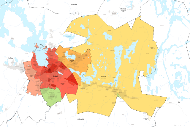
Suomi: Kartta Lahden kaupungin alueliitoksista. |
|||
| Date | ||||
| Source |
Own work, data via MML old printed maps and MML Topographic map.
|
|||
| Author | Fenn-O-maniC |

Licensing[edit]
This file is licensed under the Creative Commons Attribution 4.0 International license.
- You are free:
- to share – to copy, distribute and transmit the work
- to remix – to adapt the work
- Under the following conditions:
- attribution – You must give appropriate credit, provide a link to the license, and indicate if changes were made. You may do so in any reasonable manner, but not in any way that suggests the licensor endorses you or your use.
File history
Click on a date/time to view the file as it appeared at that time.
| Date/Time | Thumbnail | Dimensions | User | Comment | |
|---|---|---|---|---|---|
| current | 08:54, 9 February 2024 | | 4,800 × 3,200 (804 KB) | Fenn-O-maniC (talk | contribs) | Uploaded a work by Fenn-O-maniC from {{own}}, data via [https://www.maanmittauslaitos.fi/asioi-verkossa/vanhat-painetut-kartat MML old printed maps] and MML Topographic map. {{MML|Maastokartta 1:250 000|2023}} Information of old borders from "Lahden historia" (1980) p. 14 by O. Turpeinen with UploadWizard |
You cannot overwrite this file.
File usage on Commons
The following page uses this file: