
Lyttos test triathlon 5-9-2021 Photo Gallery
2 October 2021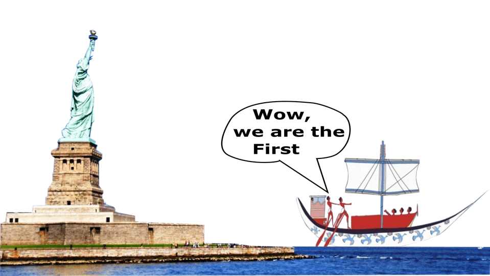
Crete did it first
30 August 2022
The best map of Crete for cycling, outdoor activities, and alternative tourism.
A map to promote the outdoor tourism in Crete, support the small villages and help to extend the tourist season.
An effort to create a good map for cyclists ended with the best, most accurate and most useful map of Crete. A map that is not only for cycling tourism, but at the same time for wine tourism, religious tourism, mountaineering, canyoning, speleology, climbing tourism... and many more.
A map to give a little help to the hinterland of Crete to develop tourism. The treasure of Crete and its great advantage is the nature, geography, climate, history, cultural heritage, the Cretan cuisine. Everyone can benefit through the development of alternative tourism all year round. Our purpose is to help our villages stay alive.
A unique method of highlighting the interesting places of Crete.
The map is easy to read and playful. All points of interest are depicted with a special symbol which is very easy to recognize without confusing the different elements.
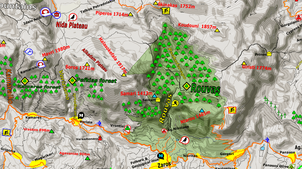
Detail of Zaros village. An area famous for hiking and alternative tourism. See the detail, Pine tree forests and Oak tree forests are depicted with different tree symbol.
100% up to date
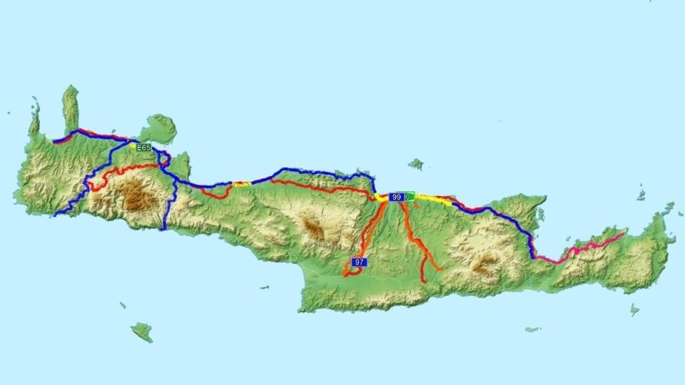
On the map are depicted all the new roads which were constructed until February 2022. The new road of Stoumpoulas plateau (currently closed), the new asphalt road from Zoniana village to Psiloritis mountain or even the new (under construction) road to Kasteli airport.
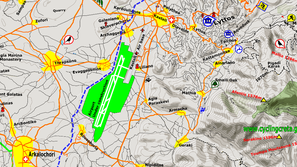
Detail of the new airport of Kasteli and the road which are under construction.
Special points of interest
Additional points of interest that most maps do not show. We have depicted the visitable wineries and Olive oil mills, the museums, all the archeological sites, the Venetian fortresses and the Ottoman castles. Our method is unique.
Easy to follow
The roads are designed in a way that is easy to recognize which route to follow with the car or road bike. Especially the road cyclists can see which roads are good for cycling which to avoid because of the traffic and which roads are very steep to climb. The greatest road cycling climbs are highlighted.

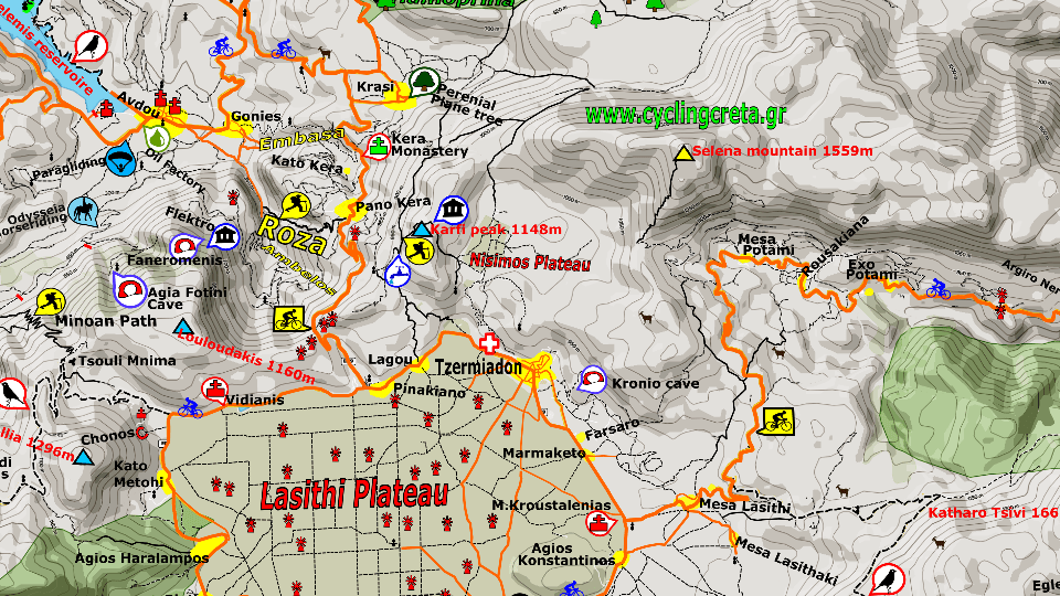
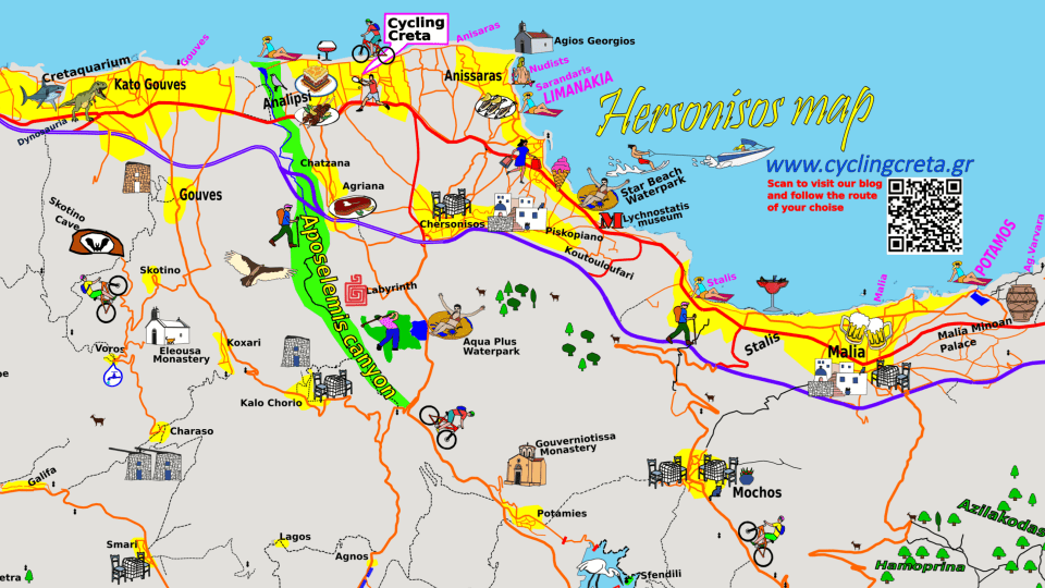
Detail from Hersonissos area.
A map to learn and explore Crete
The easiest way to learn and find where are the canyons, the forests, the caves, the plateaus and all the elements of the Cretan nature.
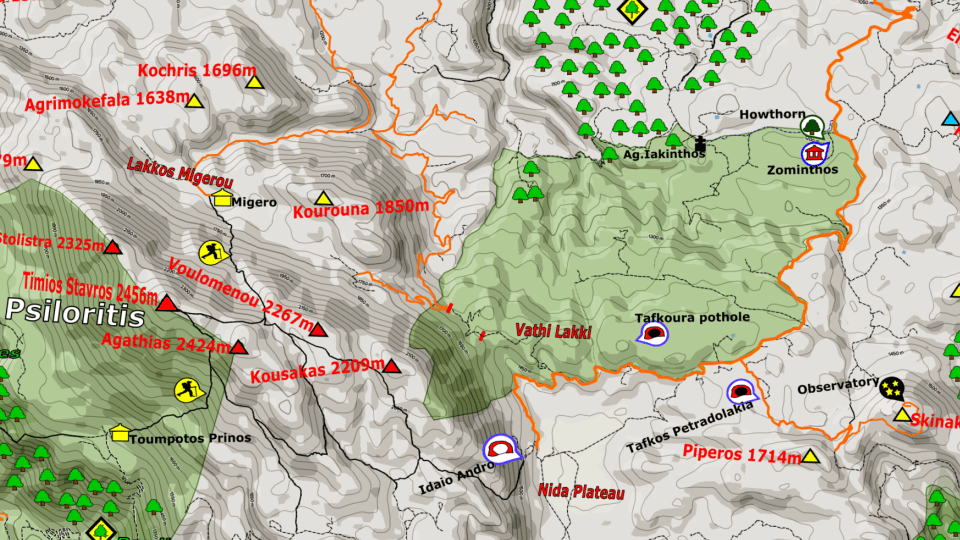
Detail from Psiloritis mountain.
A map to support our villages
The map is made to promote the outdoor tourism in Crete, support the small villages and help to extend the tourist season. It does not just shows where the villages are but promotes and highlights them through the activities that are close to them.
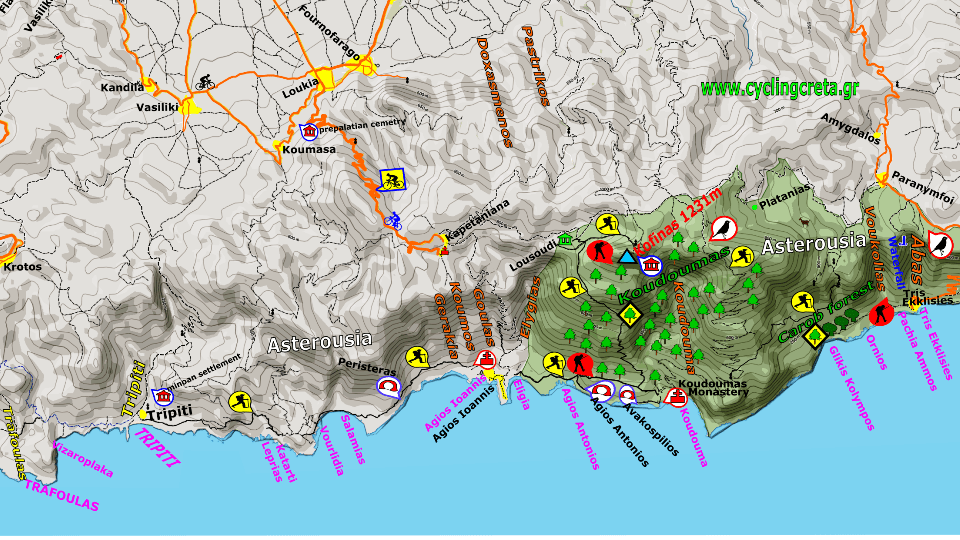
Detail of Kapetania village and Asterousia mountains. An area full of outdoor activities.
Map Legend. Icons and symbols.
The map is user friendly and fun. We use many different symbols, icons, colors and fonts. Reading the map is easy and interesting without getting tired from the many information. All points of interest are displayed with different symbols so that they are easy to find.
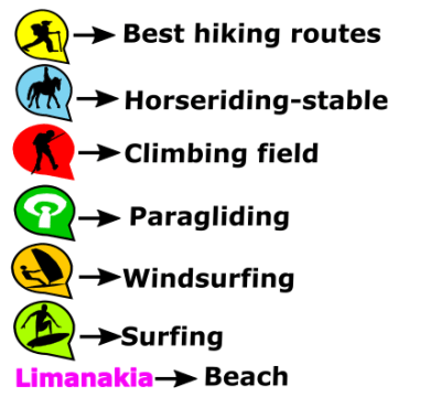
Some of the symbols we use for outdoor activities.
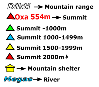
Some of the symbols we use for mountains. Each peak is depicted with different color depending on the altitude.
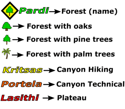
The different symbols we use for forests, canyons and plateaus. We use different tree symbol to show the area of a Pine or Oak forest. With a different color (yellow) are depicted the canyons that are easy for hiking and those that require technical equipment (orange).
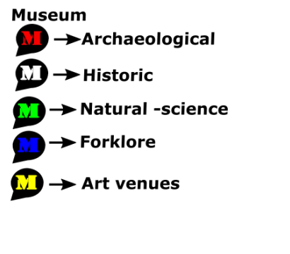
We use the same symbol for museums but with different color depending on the type of museum.
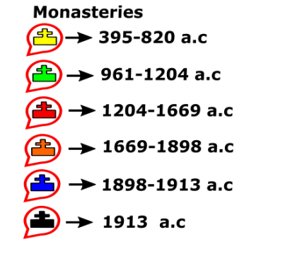
We use the same symbol for monasteries but with different color depending on the era the monastery was founded.
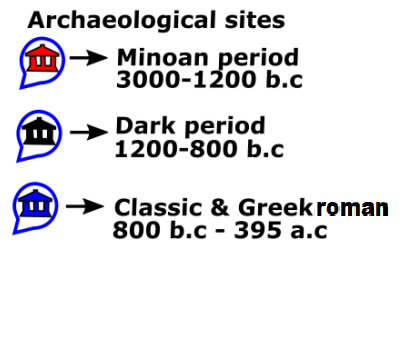
We use the same symbol for the archaeological sites but with different color depending on the historic era.
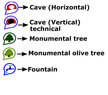
Symbols for caves and monumental trees.
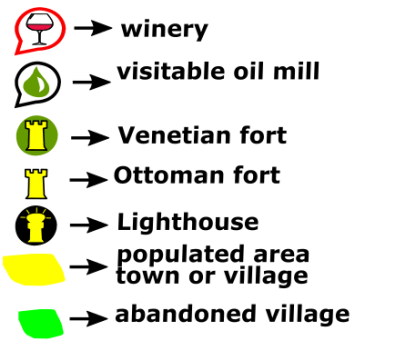
We depict all the visitable wineries of Crete as well as Olive oil mills for oil testing. We also use a different symbol for the Venetian or the Ottoman fortresses.

Some other symbols useful for the travelers.
As a basis for our map we used the open street maps which we completed, modified and enriched in our own unique way.
Other sources:Google earth
https://www.kastra.eu/
http://odysseus.culture.gr/index_gr.html
See also
The bike regions of Crete
Download cycling routes at famous areas of Crete

Are the roads of Crete good for cycling?
An article about the roads of Crete from our blog
Related posts

26 August 2019