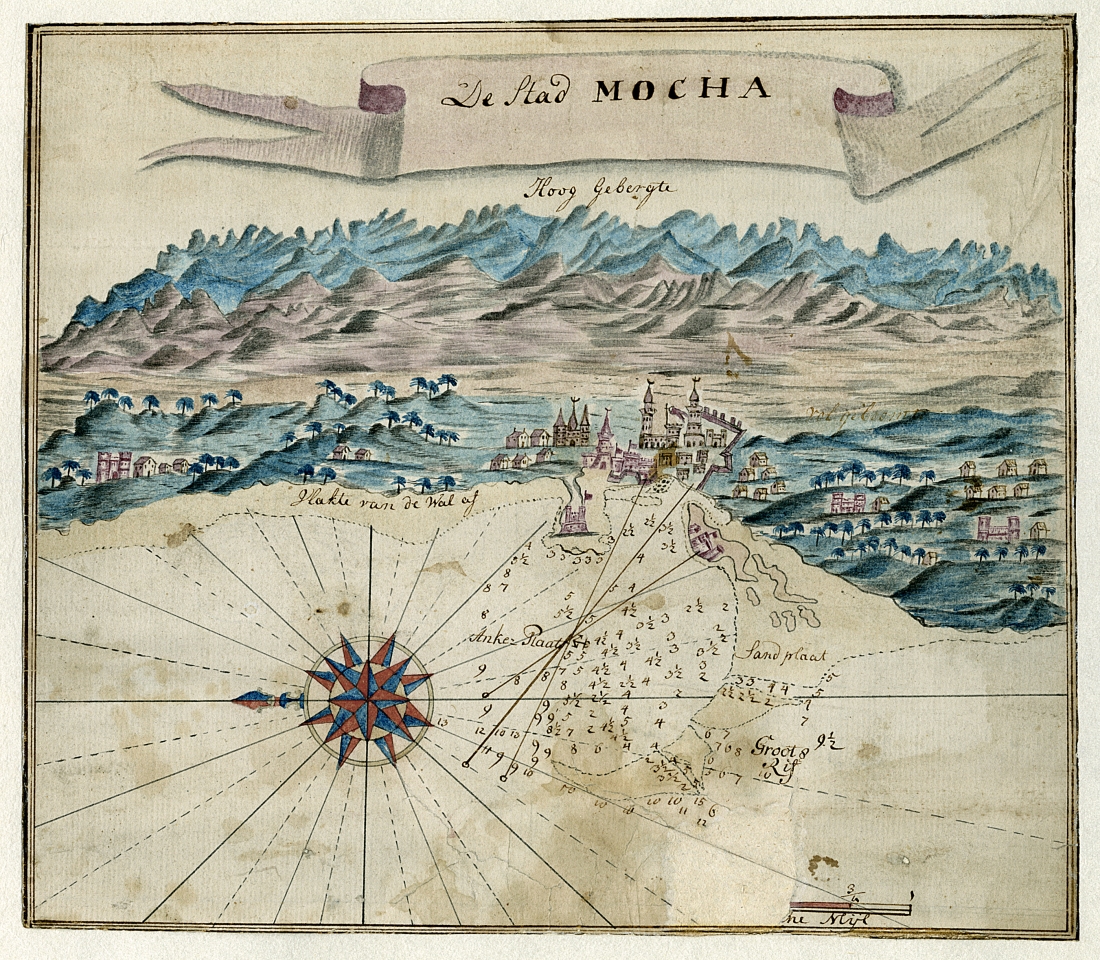
De Stad Mocha, Anonymous, 1734
Dutch Hand-Drawn Map
On loan to the Smith College Mortimer Rare Book Room from Dean Cycon
The early modern map is a document that proved to travelers and explorers that a place really did exist, and showed them where it was and how they might be able to get there. These are the expectations that we have of maps today, too. Though it isn’t usually what we expect from a map, sometimes they push beyond their purposes to include an imagined landscape of the destination. This is the case of a 1734 Dutch East India Company map of Mocha, a port city in southeast Yemen, shown above.
This map of Mocha is an entry point to understanding the history of travel in Yemen, a place that the white West is largely unfamiliar with. The anonymous Dutch cartographer who created the Mocha map gives the 18th century traveller both the navigational tools to get there and an idea of what they might expect to see when they arrive. The map is decorated with a storybook-like drawing of Yemen’s port city, Mocha, presenting the traveler with high mountains, buildings, castles, and possibly even a mosque. This map was created during the peak of the Dutch East India Company’s operations in Yemen.

