Map of Helsinki, Finland
Helsinki Map
Our Helsinki map collection shows the city’s major landmarks, neighborhoods, and transportation options.
We also include an interactive map for you to get started with learning more about the capital city of Finland.
So if you’re looking to download and possibly print a map of Helsinki, this collection has some of your best options.
Jump To: Interactive Map | Printable Road Map | 10 Things to Do | Reference Map
Helsinki map collection
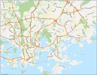
Interactive Map of Helsinki
Let’s start with a handy interactive map of the city’s surroundings. You’ll notice that the city center is Helsinki’s commercial area and is dominated by the impressive Senate Square. This plaza features several of the city’s most famous buildings, including the Lutheran Cathedral and the Government Palace.
While checking out this interactive map, you’ll also notice Helsinki’s impressive waterfront. Helsinki is located on the shore of the Gulf of Finland, and the city’s waterfront is a major draw for tourists. By using this map, you’ll get to see the many harbors, marinas, and beaches that line the coast.
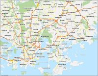
Helsinki Road Map
Helsinki has a comprehensive public transportation system that includes buses, trams, and a subway line. But this Helsinki road map highlights the different motorways and routes for these modes of transport. Each type of route is color-coded so you can differentiate between them, including road names and highway numbers.
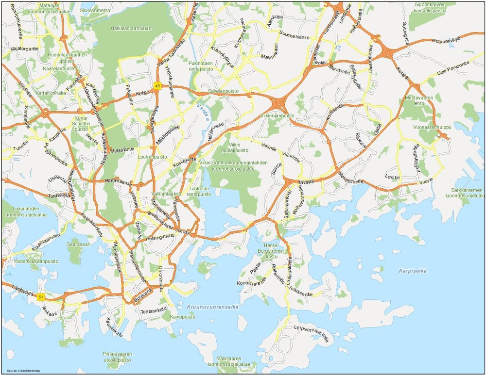
Highways: 45, 51
Major Roads: Mäkelänkatu, Hämeentie, Teollisuuskatu, Junatie, Metsäläntie, Nuijameistetnie, Mannerheimintie, Paciuksenkatu, Huopaladhentie, Mechelininkatu, Mannerheimintie, Mäkitorpantie, Kirkonkyläntie, Unioninkatu, Itäväylä, Länismäentie, Rajakyläntie, Malminkaari, Alankotie, Rajatorpantie, Vuotie
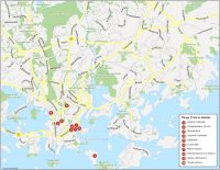
10 Things To Do in Helsinki
The Helsinki Cathedral, Temppeliaukion Church, and Suomenlinna all top our list of 10 things to do in Helsinki. Despite being a busy city, Helsinki is also known for its many parks and green spaces. Our map highlights the expansive Esplanadi Park, which is located between Erottaja Square and Market Square. You’ll also find the popular amusement park, Linnanmaki, and the National Museum of Finland, which encompasses Finnish history all the way back to the Stone Age.
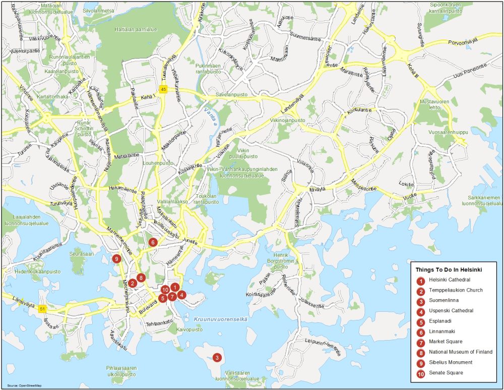
Helsinki is the capital and largest city of Finland, located on the southern coast of the country. Here are the top 10 things to do that we recommend doing.
- Helsinki Cathedral
- Temppeliaukion Church
- Suomenlinna
- Uspenski Cathedral
- Esplanadi
- Linnanmaki
- Market Square
- National Museum of Finland
- Sibelius Monument
- Senate Square
Helsinki Reference Map
Helsinki is divided into several distinct neighborhoods, each with its own unique character. Some of the most popular neighborhoods for visitors include Kallio, known for its trendy restaurants, and Punavuori, which is home to many boutiques and galleries. Use this map to explore Helsinki, Finland which includes the surrounding towns and villages.

Water Features: Vantaa River, Karpiselkä, Kruunuvuorenselkä
Parks: Vallilanlaakso, Toukolan Rantapuisto, Louhenpuisto, Hiidenkiukaanpuisto, Henrik Borgströmin Puisto
Communities: Kallio, Punavuori, Ruoholahti, Merihaka, Kruununhaka, Katajanokka, Eira, Hernesaari, Lauttasaari, Salmisaari, Töölö, Meilahti, Harju, Kallio, Alppila, Laakso, Pasila, Vallila, Hermanni, Sompasaari, Kivihaka, Ruskeasuo, Käpylä, Vanhakaupunki, Metsälä, Koskela, Oulunkylä, Maunula, Pirkkola, Maununneva, Länsi-Pakila, Hakuninmaa, Itäkeskus, Pihlajamäki, Rajakylä, Lassila