Suomusjärvi
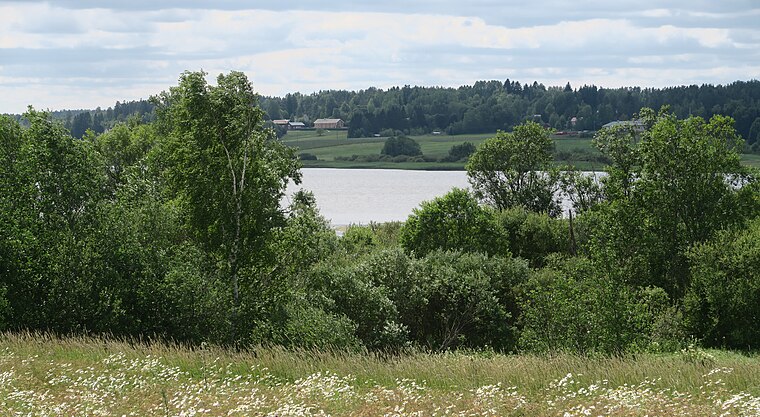
Suomusjärvi is a former municipality in Finland Proper, today part of Salo. It was a common stop on present highway 110 when it was highway 1. The administrative centre was Kitula, while the former parish village is 3 km farther towards Helsinki.Photo: Abc10, CC BY-SA 3.0.
Photo: Abc10, CC BY-SA 3.0.
Notable Places in the Area
Suomusjärvi
- Type: Town with 1,310 residents
- Description: former municipality of Finland, now part of Salo
- Categories: former municipality of Finland, municipality of Finland and locality
- Location: Salo, Salo, Finland Proper, West Coast, Finland, Nordic countries, Europe
- View on OpenStreetMap
Latitude
60.3807° or 60° 22' 50" northLongitude
23.5926° or 23° 35' 33" eastPopulation
1,310Elevation
105 metres (344 feet)Open Location Code
9GG59HJV+72OpenStreetMap ID
node 33130756OpenStreetMap Feature
place=townGeoNames ID
635698Wikidata ID
Q1641656Suomusjärvi Satellite Map
© OpenStreetMap, Mapbox and Maxar
Also Known As
- Cebuano: Suomusjärvi
- Dutch: Suomusjarvi
- Dutch: Suomusjärvi
- Esperanto: Suomusjärvi
- Finnish: Suomusjärven kunta
- Finnish: Suomusjärvi
- French: Suomusjarvi
- French: Suomusjärvi
- German: Suomusjärvi
- Inari Sami: Suomusjärvi
- Irish: Suomusjärvi
- Italian: Suomusjärvi
- Japanese: スオムスヤルヴィ
- Northern Sami: Suomusjärvi
- Norwegian: Suomusjärvi
- Norwegian Bokmål: Suomusjärvi
- Romanian: Suomusjarvi
- Romanian: Suomusjärvi
- Swedish: Suomusjärvi
- Uzbek: Suomusjarvi
- Vietnamese: Suomusjärvi
- Suomusjaervi
Other Places Named Suomusjärvi
Localities in the Area
- LaperlaHamlet
- NuppulankulmaHamlet
- HäntäläVillage
- YltäkyläHamlet
- AhtialaHamlet, 3½ km south
Popular Destinations in Finland Proper
Discover Turku, Uusikaupunki, Kaarina and Naantali.
Escape to a Random Place
Explore your world with these selected destinations of excellence.
About Mapcarta. Thanks to Mapbox for providing amazing maps. Data © OpenStreetMap contributors and available under the Open Database License. Text is available under the CC BY-SA 4.0 license, excluding photos, directions and the map. Description text is based on the Wikivoyage page Suomusjärvi. Photo: Abc10, CC BY-SA 3.0.