Share

Scan the QR code and open PeakVisor on your phone
Scan the QR code and open PeakVisor on your phone
Located on the Sechelt Peninsula on British Columbia’s Sunshine Coast, Spipiyus Provincial Park, also known as the Caren Range Old-Growth Forest, protects the oldest closed-canopy temperate rain forest in Canada. The park was established in 1999 after years of campaigning by local conservation groups.

In the early 90s, the Friends of Caren group petitioned the Canadian government to create a shore-to-summit park surrounding the Caren Range. After almost 10 years, a small part of the original old-growth forest was preserved. Unfortunately, it would take several more years for the upper elevations of the Caren Range to receive the same protections.
Spipiyus earns its name from the local Sechelt Indian Band’s name for the Marbled Murrelet, a small, squat seabird that only nests in old-growth forests. Spipiyus protects a colony of Marbled Murrelets, a species that has been greatly impacted due to deforestation in the area. The first active Marbled Murrelet nests were discovered in the park in the early 90s.
Despite extensive logging in the region, Spipiyus Provincial Park’s remaining band of high-elevation old-growth forest serves as a critical habitat to the red-listed Marbled Murrelet and continues to play an important role in the species’ survival.
Spipiyus also protects Canada’s oldest living Yellow Cedars. In 1993, an 1,835-year-old yellow cedar stump was discovered in the region. Sadly, this means that the oldest recorded tree in Canada was cut down in a large clear-cut operation in the 1980s.
Spipiyus Provincial Park contains just two named peaks: Spipiyus Peak and Mount Hallowell, the latter being the park’s most popular hiking destination.
The park contains no day use areas or picnic facilities, though a number of old logging roads are suitable for hiking and walking.
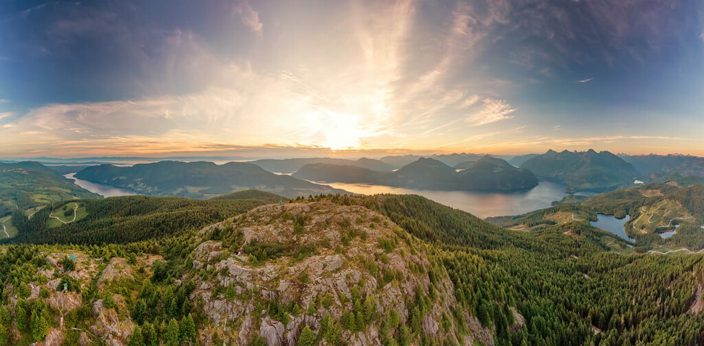
Located in Spipiyus Provincial Park, Mount Hallowell is a forested, dome-shaped summit that offers sweeping views of the Sunshine Coast. The summit also boasts a dilapidated fire lookout. There are two main routes to the summit. The first route can be accessed via Trout Lake Rd. in Halfmoon Bay and requires a 4-wheel drive vehicle. This route is considerably shorter than the alternative route, which can be accessed via Malaspina Substation Rd. in Pender Harbour.
Tucked in the southwest corner of British Columbia, the aptly named Sunshine Coast is a 110-mile scenic stretch of highway that travels from Desolation Sound to Howe Sound. The aptly named, the Sunshine Coast lies in the rain shadow of the Vancouver Island mountains and boasts between 1,400 and 2,400 hours of sunshine annually.
A variety of oceanside communities along the coast offer plenty of dining, shopping, and lodging options. Accommodations vary from full-service spas and vacation rentals to hostels, campgrounds, and bed and breakfasts. The Sunshine Coast is also known for its spectacular outdoor recreation opportunities, including scenic hiking, mountain biking, and backcountry skiing trails.

The Sunshine Coast is intersected by the large fjord of Jervis Inlet. The South Coast is home to several charming communities, including Gibsons, Sechelt, and Pender Harbour, and is considered an ideal summer vacation destination.
On the North Coast, Powell River is the most popular destination. This eccentric community is home to funky café’s, a craft brewery, and restaurants with international flair. The North Coast also houses the Sunshine Coast Trail, Canada’s longest hut-to-hut hiking trail.

Explore Spipiyus Provincial Park with the PeakVisor 3D Map and identify its summits.