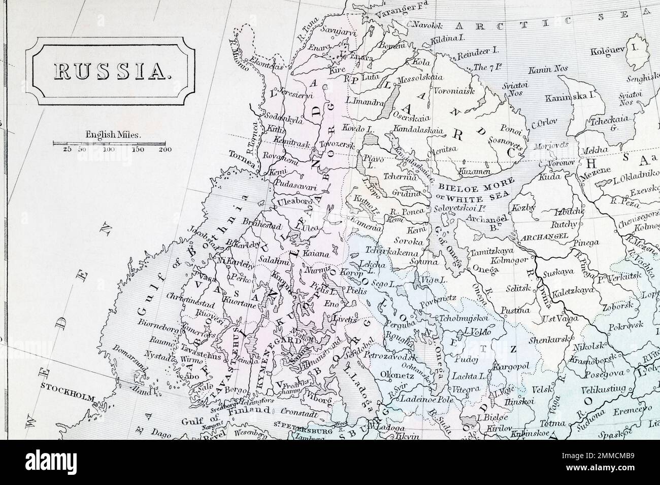
c. 1850 / 60 Atlas map of Finland and surrounding Baltic states. For Finland territory changes, Finland borders, Russia-Finland relations & hostility.
Image details
Contributor:
Marcus Harrison - geopolitics / Alamy Stock PhotoImage ID:
2MMCMB9File size:
128.6 MB (5.7 MB Compressed download)Releases:
Model - no | Property - noDo I need a release?Dimensions:
8213 x 5475 px | 69.5 x 46.4 cm | 27.4 x 18.3 inches | 300dpiDate taken:
27 January 2023Location:
ukMore information:
From Dr BUTLER'S Atlas, or ATLAS OF MODERN GEOGRAPHY by Samuel Butler. - The atlas has no covers and is undated in terms of a printed publication date. Looking at layout I think this slightly older that an 1830s copy I have of this Atlas. - I think this is likely to be out of copyright, but you should do due diligence for commercial uses. By all accounts (at least according to the Bodleian Library) general Atlas map copyright in the UK exists for 70 years after the date of publication - and not 70 years after the author's / originator's death as with literary works. See https://www.bodleian.ox.ac.uk/maps/reproducing-maps.#### - Russian history dates to put its' complex patchwork world into perspective... - - 1807 Treaties of Tilsit - 1812 Patriotic War (Napoleon) - 1814-15 Congress of Vienna - 1853-56 Crimean War - 1870-71 Franco-Prussian War - 1882 Triple Alliance - 1889-1901 Boxer Revolution - 1900-01 Eight-Nation Alliance - 1905-06 October Manifesto - 1907 Anglo-Russian Convention / Entente - 1917 October Revolution